|
|
|
|
|
|
|
|
|
|
|
|
|
|
|
|
|
|
|
|
|
|
|
|
|
|
|
|
|
|
|
RALLEIO HIGH SCHOOL OF PIRAEUS FOR GIRLS
147
Karaiskou str. & Bouboulinas
PC
18535
PIRAEUS
TEL 0030210-4297425
FAX 0030210-4297424
mail@gym-ralleion.att.sch.gr
|
|
|
|
 |
|
|
|
Comenius partners
(2008-2010) |
|
|
|
|
Republic of Bulgaria
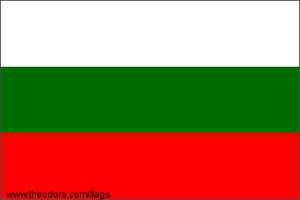
The flag of Bulgaria
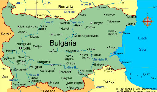
The map of Bulgaria
F
Partner School
Link
Bulgaria shares borders with
Serbia, FYROM, Romania, Greece, and Turkey. Two mountain ranges
and two great valleys mark the topography of Bulgaria, situated on
the Black Sea. The Maritsa (Evros) is Bulgaria's principal river,
and the Danube also flows through the country.
President:
Georgi Purvanov (2002)
Prime Minister:
Sergei Stanishev (2005)
Land area:
110,549 sq km; total area: 10,910 sq km
Population (2008 est.):
7,262,675 (growth rate: –0.8%); birth rate: 9.5/1000; infant
mortality rate: 18.5/1000; life expectancy: 72.8; density per sq
mi: 65
Capital and largest city (2003 est.):
Sofia, 1,088,700
Other large cities:
Plovdiv, 338,200; Varna, 312,300; Burgas, 192,000; Ruse, 161,000
Monetary unit:
Lev
Languages:
Bulgarian 85%, Turkish 10%, Roma 4%
Ethnicity/race:
Bulgarian 83.9%, Turk 9.4%, Roma
4.7%, other (including Armenian, Tatar, Circassian) 2% (2001)
National Holiday:
Liberation Day, March 3
Religions:
Bulgarian Orthodox 83%, Islam 12%,
other Christian 1% (2001)
Literacy rate:
98.2% (2006 est.)
Economic summary:
GDP per capita $11,300. Real growth rate: 6.2%.
Inflation: 7.6%. Unemployment: 7.7%. Arable land:
40%. Agriculture: vegetables, fruits, tobacco, wine, wheat,
barley, sunflowers, sugar beets; livestock. Labor force:
3.34 million; agriculture 11%, industry 32.7%, services 56.3% (3rd
quarter 2004 est.). Industries: electricity, gas, water;
food, beverages, tobacco; machinery and equipment, base metals,
chemical products, coke, refined petroleum, nuclear fuel.
Natural resources: bauxite, copper, lead, zinc, coal, timber,
arable land. Exports: $11.67 billion f.o.b. (2005 est.):
hing, footwear, iron and steel, machinery and equipment, fuels.
Imports: $15.9 billion f.o.b. (2005 est.): machinery and
equipment; metals and ores; chemicals and plastics; fuels,
minerals, and raw materials. Major trading partners: Italy,
Germany, Turkey, Belgium, Greece, U.S., France, Russia (2004).
Communications: Telephones:
main lines in use: 2,868,200 (2002); mobile cellular: 2,597,500
(2002). Radio broadcast stations: AM 31, FM 63, shortwave 2
(2001). Television broadcast stations: 39 (plus 1,242
repeaters) (2001). Internet hosts: 53,421 (2004).
Internet users: 630,000 (2002).
Transportation: Railways:
total: 4,294 km (2004). Highways: total: 37,077 km; paved:
34,111 km (including 328 km of expressways); unpaved: 2,966 km
(2002). Waterways: 470 km (2004). Ports and
harbors: Burgas, Varna. Airports: 213 (2004 est.).
|
|
|
Republic of Poland
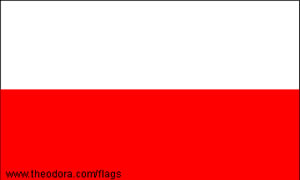
The flag of Poland
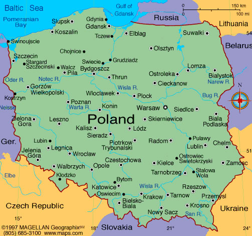
Map of Poland
F
Partner School
Link
Poland, is in north-central
Europe. Most of the country is a plain with no natural boundaries
except the Carpathian Mountains in the south and the Oder and
Neisse rivers in the west. Other major rivers, which are important
to commerce, are the Vistula, Warta, and Bug.
National name:
Rzeczpospolita Polska
President:
Lech Kaczynski (2005)
Prime Minister:
Jaroslaw Kaczynski (2006)
Land area:
304,509 sq km total area: 312,685 sq km
Population (2007 est.):
38,518,241 (growth rate: 0.0%); birth rate: 9.9/1000; infant
mortality rate: 7.1/1000; life expectancy: 75.2; density per sq
mi: 328
Capital and largest city (2003 est.):
Warsaw, 2,201,900 (metro. area),
1,607,600 (city proper)
Other large cities:
Lodz, 778,200; Krakow, 733,100; Wroclaw, 632,200; Poznan, 581,200;
Gdansk, 456,700; Szczecin, 415,700
Monetary unit:
Zloty
Language:
Polish 98% (2002)
Ethnicity/race:
Polish 96.7%, German 0.4%,
Belorussian 0.1% Ukrainian 0.1%, other 2.7% (2002)
Religions:
Roman Catholic 90% (about 75%
practicing), Eastern Orthodox 1%, Protestant and other (2002)
Literacy rate:
100% (2003 est.)
Economic summary:
GDP per capita $16,300. Real growth rate: 6.5%.
Inflation: 2.5%. Unemployment: 12.8%. Arable land:
40%. Agriculture: potatoes, fruits, vegetables, wheat;
poultry, eggs, pork, dairy. Labor force: 17.1 million;
agriculture 16.1%, industry 29%, services 54.9% (2007).
Industries: machine building, iron and steel, coal mining,
chemicals, shipbuilding, food processing, glass, beverages,
textiles. Natural resources: coal, sulfur, copper, natural
gas, silver, lead, salt, amber, arable land. Exports:
$137.9 billion f.o.b. (2007 est.): machinery and transport
equipment 37.8%, intermediate manufactured goods 23.7%,
miscellaneous manufactured goods 17.1%, food and live animals 7.6%
(2003). Imports: $150.7 billion f.o.b. (2007 est.):
machinery and transport equipment 38%, intermediate manufactured
goods 21%, chemicals 14.8%, minerals, fuels, lubricants, and
related materials 9.1% (2003). Major trading partners:
Germany, Italy, France, UK, Czech Republic, Netherlands, Russia,
China (2004).
Communications: Telephones:
main lines in use: 11.475 million (2007); mobile cellular: 36.746
million (2007). Radio broadcast stations: AM 14, FM 777,
shortwave 1 (1998). Radios: 20.2 million (1997).
Television broadcast stations: 40 (2006). Televisions:
13.05 million (1997). Internet Service Providers (ISPs):
5.681 million (2007). Internet users: 11 million (2006).
Transportation: Railways:
total: 23,072 km (2006). Highways: total: 423,997 km;
paved: 295,356 km (including 484 km of expressways); unpaved:
128,641 km (2004). Waterways: 3,997 km navigable rivers and
canals (2006). Ports and harbors: Gdansk, Gdynia, Gliwice,
Kolobrzeg, Szczecin, Swinoujscie, Ustka, Warsaw, Wroclaw.
Airports: 123 (2007).
|
|
|
Romania
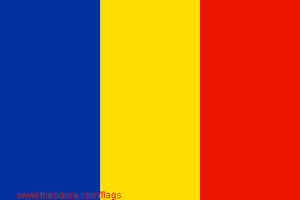
The flag of Romania
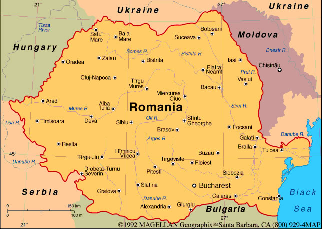
The map of
Romania
F
Partner School
Link
Romania is in southeast
Europe. The Carpathian Mountains divide Romania's upper half from
north to south and connect near the centre of the country with the
Transylvanian Alps, running east and west. North and west of these
ranges lies the Transylvanian plateau, and to the south and east
are the plains of Moldavia and Walachia. In its last 190 mi (306
km), the Danube River flows through Romania only. It enters the
Black Sea in northern Dobruja, just south of the border with
Ukraine.
Land area:
230,339 sq km total area: 237,500
sq km
Population (2007 est.):
22,276,056 (growth rate: –0.1%); birth rate: 10.7/1000; infant
mortality rate: 24.6/1000; life expectancy: 71.9; density per sq
mi: 250
Capital and largest city (2003 est.):
Bucharest, 2,210,800 (metro. area),
1,906,800 (city proper)
Other large cities:
Iasi, 320,000; Cluj-Napoca, 316,400; Timisoara, 316,100; Constanta,
309,000;
Craiova, 301,100,
Galati, 297,100; Brasov, 282,500
Monetary unit:
lei
Languages:
Romanian 91% (official), Hungarian
6.7%, Romany (Gypsy) 1.1%, other 1.2%
Ethnicity/race:
Romanian 89.5%, Hungarian 6.6%, Roma
(Gyspy) 2.5%, Ukrainian 0.3%, German 0.3%, Russian 0.2%, Turkish
0.2%, other 0.4% (2002)
Religions:
Eastern Orthodox (including all
sub-denominations) 86.8%, Protestant (various denominations
including Reformate and Pentecostal) 7.5%, Roman Catholic 4.7%,
other (mostly Muslim) and unspecified 0.9%, none 0.1% (2002
census)
Literacy rate:
98% (2003 est.)
Economic summary:
GDP/PPP (2007 est.): per capita $11,400. Real growth
rate: 6%. Inflation: 4.8%. Unemployment: 4.1%.
Arable land: 39%. Agriculture: wheat, corn, barley,
sugar beets, sunflower seed, potatoes, grapes; eggs, sheep.
Labor force: 9.35 million (2007 est.); agriculture 31.6%,
industry 30.7%, services 37.7% (2004). Industries: textiles
and footwear, light machinery and auto assembly, mining, timber,
construction materials, metallurgy, chemicals, food processing,
petroleum refining. Natural resources: petroleum (reserves
declining), timber, natural gas, coal, iron ore, salt, arable
land, hydropower. Exports: $39.62 billion f.o.b. (2007
est.): textiles and footwear, metals and metal products, machinery
and equipment, minerals and fuels, chemicals, agricultural
products. Imports: $63.16 billion f.o.b. (2007 est.):
machinery and equipment, fuels and minerals, chemicals, textile
and products, basic metals, agricultural products. Major
trading partners: Italy, Germany, France, Turkey, UK, Russia
(2004).
Communications: Telephones:
main lines in use: 4.231 million (2006); mobile cellular: 17.4
million (2006). Radio broadcast stations: 698 (frequency
type NA) (2006). Radios: 7.2 million (1997). Television
broadcast stations: 623 (plus 200 repeaters)(2006).
Televisions: 5.25 million (1997). Internet Service
Providers (ISPs): 1.406 million (2007). Internet users:
5.063 million (2006).
Transportation: Railways:
total: 11,385 km (3,888 km
electrified) (2002). Highways: total: 198,817 km; paved:
60,043 km (including 228 km of expressways); unpaved: 138,774 km
(2004). Waterways: 1,731 km (2006). Ports and harbors:
Braila, Constanta, Galati, Mangalia, Sulina, Tulcea. Airports:
65 (2002).
|
|
|
Republic of Turkey
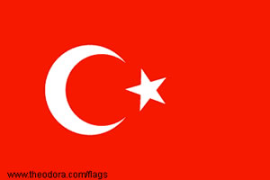
The flag of Turkey
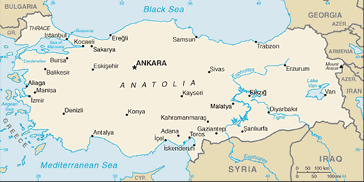
The map of Turkey
F
Partner School
Link
Turkey is at the northeast end
of the Mediterranean Sea in southeast Europe and southwest Asia.
To the north is the Black Sea and to the west is the Aegean Sea.
Its neighbors are Greece and Bulgaria to the west, Russia,
Ukraine, and Romania to the north and northwest (through the Black
Sea), Georgia, Armenia, Azerbaijan, and Iran to the east, and
Syria and Iraq to the south. The Dardanelles (Ellispontos), the
Sea of Marmara, and the Bosporus divide the country. Its center is
a treeless plateau rimmed by mountains.
National name:
Türkiye Cumhuriyeti
President:
Abdullah Gul (2007)
Prime Minister:
Recep Tayyip Erdogan (2003)
Land area:
770,761 sq km; total area: 780,580 sq km
Population (2007 est.):
71,158,647 (growth rate: 1.0%); birth rate: 16.4/1000; infant
mortality rate: 38.3/1000; life expectancy: 72.9; density per sq
mi: 239
Capital (2003 est.):
Ankara, 3,582,000 (metro. area),
3,456,100 (city proper)
Largest cities:
Istanbul, 9,760,000 (metro. area), 8,831,805 (city proper); Izmir,
2,398,200; Bursa, 1,288,900; Adana, 1,219,900;
Gaziantep, 979,500
Monetary unit:
Turkish lira (YTL)
Languages:
Turkish (official), Kurdish, Dimli,
Azeri, Kabardian
Ethnicity/race:
Turkish 80%, Kurdish 20% (estimated)
Religions:
Islam (mostly Sunni) 99.8%, other
0.2% (mostly Christians and Jews)
Literacy rate:
87.4% (2004 est.)
Economic summary:
GDP per capita $12,900. Real growth rate: 5%.
Inflation: 8.8%. Unemployment: 9.9% (plus
underemployment of 4.0%). Arable land: 30%. Agriculture:
tobacco, cotton, grain, olives, sugar beets, pulse, citrus;
livestock. Labor force: 23.53 million (2007); note: about
1.2 million Turks work abroad; agriculture 35.9%, industry 22.8%,
services 41.2% (3rd quarter, 2004). Industries: textiles,
food processing, autos, electronics, mining (coal, chromite,
copper, boron), steel, petroleum, construction, lumber, paper.
Natural resources: antimony, coal, chromium, mercury, copper,
borate, sulfur, iron ore, arable land, hydropower. Exports:
$72.49 billion f.o.b. (2005 est.): apparel, foodstuffs, textiles,
metal manufactures, transport equipment. Imports: $101.2
billion f.o.b. (2005 est.): machinery, chemicals, semifinished
goods, fuels, transport equipment. Major trading partners:
Germany, UK, U.S., Italy, France, Spain, Russia, China (2004).
Communications: Telephones:
main lines in use: 19.5 million (1999); mobile cellular: 17.1
million (2001). Radio broadcast stations: AM 16, FM 107,
shortwave 6 (2001). Radios: 11.3 million (1997).
Television broadcast stations: 635 (plus 2,934 repeaters)
(1995). Televisions: 20.9 million (1997). Internet
Service Providers (ISPs): 50 (2001). Internet users:
2.5 million (2002).
Transportation: Railways:
total: 8,607 km (2002). Highways: total: 385,960 km; paved:
131,226 km (including 1,749 km of expressways); unpaved: 254,734
km (1999). Waterways: about 1,200 km. Ports and harbors:
Gemlik, Hopa, Iskenderun, Istanbul, Izmir, Kocaeli (Izmit),
Icel (Mersin), Samsun, Trabzon. Airports: 120 (2002).
|
|
|
|
|
|
 Back
Back |
|
|
|
|